Land Minister Saifuzzaman Chowdhury said that it will be possible to conduct a digital survey of Bangladesh in a very short time, instead of 20-25 years which is the usual time for a conventional land survey. A draft map will be prepared and put on the website so that the land owner can immediately file an objection if the amount of land is more or less by looking at the map of his land from anywhere in the world as soon as the survey begins. There will be transparency in the survey, the lawsuit will be reduced, and the suffering of the people will also be reduced Since all the information in the digital survey is digital and accurate.
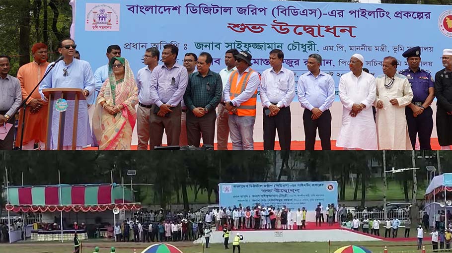
This was said by Land Minister Saifuzzaman Chowdhury after inaugurating the piloting of the Bangladesh Digital Survey (BDS) in the field adjacent to the Deputy Commissioner's office in Patuakhali on Wednesday. This time Land Secretary Md. Mustafizur Rahman PAA was present.
The piloting of digital survey using the latest fourth-generation survey drone is starting from Patuakhali For the first time in Bangladesh. As RS survey was not completed after the SA survey in Patuakhali and Barguna districts, 14 Upazilas of these two districts have been selected for BDS. This survey will start from the Itbaria Union of Sadar Upazila of Patuakhali.
Patuakhali Awami League district branch president heroic freedom fighter Kazi Alamgir, general secretary heroic freedom VP Abdul Mannan and member of national parliament elected from reserved women's constituency-29 Kazi Kaniz Sultana Helen were present as guests of honor.
Barisal Additional Divisional Commissioner Md Wahedur Rahman, Land Ministry Additional Secretary Pradeep Kumar Das, BDS Program Project Director Md Abdul Mannan, Land Records and Survey Directorate Director ATM Nasir Mia and Patuakhali Deputy Commissioner Mohammad Kamal Hossain, Patuakhali Superintendent of Police Mohammad Shahidullah along with Officials of Land Ministry and Patuakhali district administration, local politicians, local civil society leaders, and media related persons were also present at the event.
The Minister of Land started his speech after paying humble respect to the Father of the Nation Bangabandhu Sheikh Mujibur Rahman, his family, and all other martyrs of August 15. He then said, the Hon'ble Prime Minister during his visit to the Ministry of Lands ordered to carry out digital survey to reduce the length of time in survey work and the harassment of people. Thus we have taken this initiative.
Saifuzzaman Chowdhury also said in his speech that a digital land zoning map is being created by purchasing satellite image through another project and coordinating it with the Mauza map, as a result of which it will be possible to the planned use of land including protecting agricultural land, wetlands, hills, and forests.
Saifuzzaman Chowdhury believes that there will be a revolutionary change in land management, as, due to NID integration, a digital database will be developed regarding land ownership, class and type etc. which in turn facilitates the development of Upazila, district, divisional and national database. He said, once the BDS is done properly, there will be no need to re-survey the field because when the land is handed over, AC Land can partition the map by inputting necessary data. By clicking on a specific spot on the map, one can get the land ownership, amount of land, boundaries, and other information about that Daag number.
The land minister said that a private establishment capable of digital land survey work has been appointed experimentally for the first time to prepare the map of BDS piloting, but the work of preparing the survey Record of RIhts and determining the ownership will be done officially. The Land Minister expressed his hope that the Prime Minister will inaugurate BDS, which is planned to start simultaneously in the rest of the country's districts with the experience of this piloting.
Land Secretary Md. Mustafizur Rahman PAA said that the amount of land, length, width, size, etc. of land can be get from the BDS map. The map produced in this survey will have the accuracy of these land measurements down to the centimeter level.
Online appeals and hearings arrangements will be made to dispose of objections under Rule 30 and Rule 31 of the Tenancy Rules, 1955 regarding the digital survey.
The secretary said that the land of various government agencies, private land, roads, reservoirs, river canals, etc. will be identified, as a result, it will be possible to stop government land embezzlement by fraud during land registration and mutation. Besides, after the completion of this survey, it will be possible to determine and pay compensation and prevent fraud by knowing the amount of land required for acquisition based on the Daag number.
Incidentally, the Ministry of Lands took the initiative of the Bangladesh Digital Survey at a cost of Tk 1212.55 crore under the direction of the Prime Minister with the government's own funding to achieve the capability of digital surveying across the country. This survey program will be conducted through a 5-year project called 'Strengthening Operational Capacity of the Department of Land Record and Surveys (DLR&S) for Digital Survey Project'. In a relatively short period, the latest technology including Satellites, Drones/UAVs, and Ground Control Stations will be used in Bangladesh Digital Survey to accurately survey the land digitally.
For this reason, 2,60,310 geo-referencing points will be determined through a geodetic survey at the mouza level of 470 Upazilas across the country except for the three hill districts and a database of 1,33,188 mouza maps will be prepared. If the land has been previously surveyed, a new Geo Reference Mauza map will be prepared by superimposing the previous map with the newly prepared digitized map of the said survey. Besides, the Mauza map will also be synchronized with the satellite images collected from the 'Mouza & Plot Based National Digital Land Zoning Project'.
The main objective of the Bangladesh Digital Survey is to complete the cadastral survey in entire Bangladesh in a short time and reduce the need for field surveys. Apart from this, there will be no need for a revisional survey for the convenience of digital map partition if there is no major land deviation due to natural reasons in any area. The geo-referenced Mauza map determined under this project will be provided to the 'Land Management Automation' project. After the sale of the land, the map boundaries will change along with the change in the Mutated Record of Rights.
Measurement, demarcation and division of any plot of land could be possible by taking a coordinate value of the reference, distance measurement of any plot on the mouza map, length, and dimensions of the plot records, and four coordinate values of the four corners. There will be no need to install any reference geodetic pillar.